

SWardriving. Wireless Wi-Fi Wardriving.

Descriere SWardriving. Wireless Wi-Fi Wardriving.
SWardriving. Wireless Wi-Fi Wardriving.
Wireless Wi-Fi Wardriving, Warbiking, Warwalking, Warjogging, Warrailing, Wartraining, BusWardriving ...
Excellent for WarDriving, Warbiking, Warwalking, Warjogging, Warrailing, Wartraining, BusWardriving, and to scan lots of hotspots. If you Wardriving, you will not escape the location of any wireless network.
The main functions are:
* SQLite Database to track and locate Wireless Networks.
* Wireless Wi-Fi networks statistics stored in the Database.
* Update GPS data received every second.
* Accelerated Scanner on nearby Wireless Wi-Fi Networks.
* Statistics on nearby Wireless Wi-Fi networks.
* Notification service running in the background.
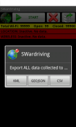
* Export KML files in the SD (for importing into Google MapsEarth, Wigle.net, ...)
* Export CSV files in the SD (separated by commas to Excel, OpenOfficeLibreOffice, ...)
* Export GEOJSON files in the SD (for importing into Geojson.io, Geojsonlint.com, Google MapsEarth, ...)
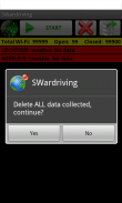
* Total elimination of the data contained in the Database.
The application uses data from GPS and Wireless Wi-Fi network scanner in combination to locate access points Wi-Fi, then save the necessary data in a database which can then be exported to a KML, CSV or GEOJSON.
To obtain the necessary data Wireless Wi-Fi network, you must wait for the device to determine the current location through GPS.
http:SWardriving.blogspot.com
http:SWifis.blogspot.com
http:Buckynet.blogspot.com


